
FORT WAYNE, Ind. (ADAMS) – The City of Fort Wayne Public Works Division is launching a new website, TRECtheFort.com, designed to improve communication with the traveling public regarding road restrictions and closures in Fort Wayne and surrounding areas.
The City says the new resource offers a more streamlined, transparent, real-time, and accessible way to stay informed about travel impacts in Fort Wayne. TREC, which stands for Traffic Related Events and Closures, will be the primary tool for Public Works to communicate road restrictions in our area.
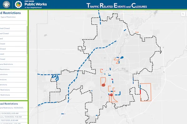
The City released the following:
The TREC website is an interactive map that illustrates the locations of road restrictions and associated detour routes along with detailed information, including:
Lane restriction or closure
The duration of the event
The activities taking place (e.g., construction, utility work, maintenance)
The contractor or department contact information
A daily email bulletin is available for those who sign up in addition to the interactive map which provides the same information available on the TREC site. The daily emails can be customized to provide updates for the whole city, or for any combination of city quadrants.
In addition to the website and email updates, the City is working to integrate this information directly into the Waze mapping app to help drivers plan their routes more efficiently.
For more information and to subscribe to daily updates, visit www.TrectheFort.com


Comments